
Thank you for supporting this site ❤️
Make a donation
Make a donation
Mont Orford topographic map
Click on the map to display elevation.
Thank you for supporting this site ❤️
Make a donation
Make a donation
About this map
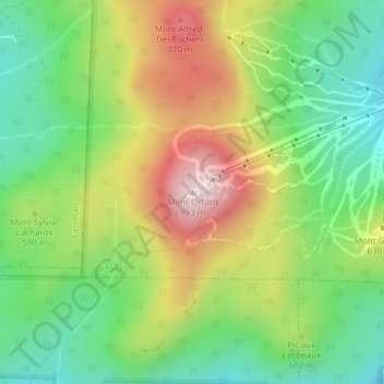
Name: Mont Orford topographic map, elevation, terrain.
Location: Mont Orford, Orford, Memphrémagog, Quebec, J1X 0R4, Canada (45.31179 -72.24183 45.31189 -72.24173)
Average elevation: 559 m
Minimum elevation: 363 m
Maximum elevation: 842 m
Thank you for supporting this site ❤️
Make a donation
Make a donation
Other topographic maps
Click on a map to view its topography, its elevation and its terrain.