
Thank you for supporting this site ❤️
Make a donation
Make a donation
Estérel topographic map
Click on the map to display elevation.
Thank you for supporting this site ❤️
Make a donation
Make a donation
About this map
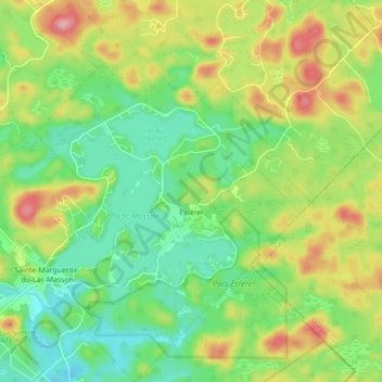
Name: Estérel topographic map, elevation, terrain.
Location: Estérel, Les Pays-d'en-Haut, Laurentides, Quebec, Canada (46.01221 -74.06024 46.07980 -73.98977)
Average elevation: 370 m
Minimum elevation: 316 m
Maximum elevation: 454 m
Thank you for supporting this site ❤️
Make a donation
Make a donation
Other topographic maps
Click on a map to view its topography, its elevation and its terrain.
Lac Saint-Louis
Canada > Quebec > Les Pays-d'en-Haut > Sainte-Marguerite-du-Lac-Masson
Average elevation: 443 m
Thank you for supporting this site ❤️
Make a donation
Make a donation
Thank you for supporting this site ❤️
Make a donation
Make a donation
Mont Edward
Canada > Quebec > Les Pays-d'en-Haut > Sainte-Marguerite-du-Lac-Masson
Average elevation: 431 m
Thank you for supporting this site ❤️
Make a donation
Make a donation
Lac Marier
Canada > Quebec > Les Pays-d'en-Haut > Sainte-Marguerite-du-Lac-Masson
Average elevation: 377 m
Thank you for supporting this site ❤️
Make a donation
Make a donation
Saint-Michel-de-Wentworth
Canada > Quebec > Les Pays-d'en-Haut > Wentworth-Nord
Average elevation: 320 m