
晋源区 topographic map
Interactive map
Click on the map to display elevation.
About this map
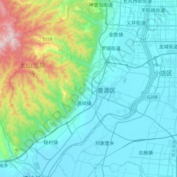
Name: 晋源区 topographic map, elevation, terrain.
Location: 晋源区, 太原市, 山西省, 中国 (37.60609 112.31901 37.82471 112.54282)
Average elevation: 947 m
Minimum elevation: 760 m
Maximum elevation: 1,850 m
Other topographic maps
Click on a map to view its topography, its elevation and its terrain.