
Make a donation
Stanfield topographic map
Click on the map to display elevation.
Make a donation
About this map
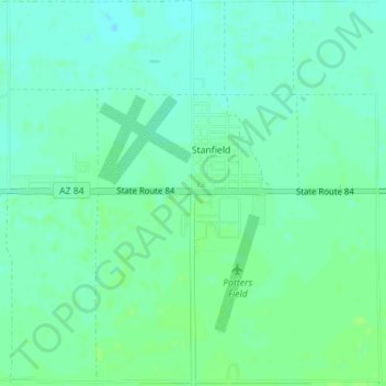
Name: Stanfield topographic map, elevation, terrain.
Location: Stanfield, Pinal County, Arizona, United States (32.86442 -111.98058 32.89397 -111.94637)
Average elevation: 396 m
Minimum elevation: 391 m
Maximum elevation: 401 m
Make a donation
Other topographic maps
Click on a map to view its topography, its elevation and its terrain.
San Manuel
United States > Arizona > Pinal County
San Manuel is located at 32°36′18″N 110°38′0″W / 32.60500°N 110.63333°W / 32.60500; -110.63333 (32.605048, -110.633340), in the San Pedro River Valley at an elevation of about 3,500 feet (1,100 m). San Manuel is approximately 45 miles (72 km) northeast of Tucson.
Average elevation: 991 m
Arizona City
United States > Arizona > Pinal County
Arizona City itself is mostly flat, lying in the Santa Cruz Valley in the center of three low mountain ranges; the Sawtooth Mountains to the south, the Picacho Mountains to the east, and the Casa Grande Mountains to the north. Picacho Peak, a prominent peak with a summit elevation of 3,374 feet (1,028 m), is…
Average elevation: 459 m
Make a donation
Biosphere 2 Research Center
United States > Arizona > Pinal County
The glass and spaceframe facility is located in Oracle, Arizona at the base of the Santa Catalina Mountains, about 50 minutes north of Tucson. Its elevation is around 4,000 feet (1,200 m) above sea level.
Average elevation: 1,159 m
Make a donation
Apache Junction
United States > Arizona > Pinal County > Apache Junction > Apache Junction
Average elevation: 524 m
Make a donation