
Thank you for supporting this site ❤️
Make a donation
Make a donation
Kodolje topographic map
Click on the map to display elevation.
Thank you for supporting this site ❤️
Make a donation
Make a donation
About this map
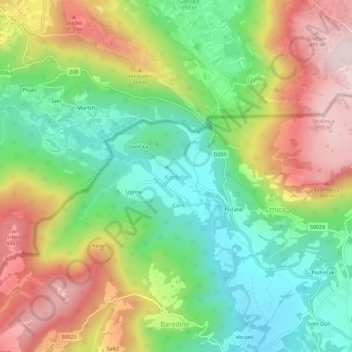
Name: Kodolje topographic map, elevation, terrain.
Location: Kodolje, Бузет, Истрийская жупания, Хорватия (45.42719 13.90029 45.46719 13.94029)
Average elevation: 245 m
Minimum elevation: 58 m
Maximum elevation: 501 m
Thank you for supporting this site ❤️
Make a donation
Make a donation
Other topographic maps
Click on a map to view its topography, its elevation and its terrain.