
张家川回族自治县 topographic map
Interactive map
Click on the map to display elevation.
About this map
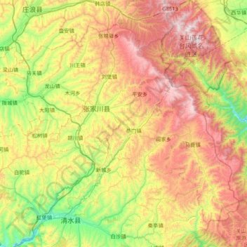
Name: 张家川回族自治县 topographic map, elevation, terrain.
Location: 张家川回族自治县, 天水市, 甘肃省, 中国 (34.73900 105.92678 35.17280 106.57514)
Average elevation: 1,865 m
Minimum elevation: 1,253 m
Maximum elevation: 2,739 m
Other topographic maps
Click on a map to view its topography, its elevation and its terrain.