
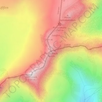
Piz Cazarauls topographic map
Interactive map
Click on the map to display elevation.
About this map
Name: Piz Cazarauls topographic map, elevation, terrain.
Location: Piz Cazarauls, Silenen, Uri, Svizzera (46.81287 8.87697 46.81297 8.87707)
Average elevation: 2,684 m
Minimum elevation: 2,164 m
Maximum elevation: 3,081 m
Other topographic maps
Click on a map to view its topography, its elevation and its terrain.