
Magdalena Bajo topographic map
Interactive map
Click on the map to display elevation.
About this map
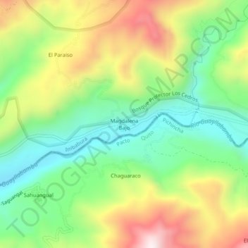
Name: Magdalena Bajo topographic map, elevation, terrain.
Location: Magdalena Bajo, García Moreno, Cotacachi, Imbabura, Ecuador (0.22163 -78.80356 0.26163 -78.76356)
Average elevation: 846 m
Minimum elevation: 563 m
Maximum elevation: 1,264 m
Other topographic maps
Click on a map to view its topography, its elevation and its terrain.
Magdalena Alto
Ecuador > Imbabura > Cotacachi
Magdalena Alto, García Moreno, Cotacachi, Imbabura, Ecuador
Average elevation: 1,204 m