
Magdalena Alto topographic map
Interactive map
Click on the map to display elevation.
About this map
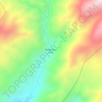
Name: Magdalena Alto topographic map, elevation, terrain.
Location: Magdalena Alto, García Moreno, Cotacachi, Imbabura, Ecuador (0.25677 -78.77638 0.29677 -78.73638)
Average elevation: 1,204 m
Minimum elevation: 737 m
Maximum elevation: 1,809 m
Other topographic maps
Click on a map to view its topography, its elevation and its terrain.
Magdalena Bajo
Ecuador > Imbabura > Cotacachi
Magdalena Bajo, García Moreno, Cotacachi, Imbabura, Ecuador
Average elevation: 846 m