
Gerunda topographic map
Interactive map
Click on the map to display elevation.
About this map
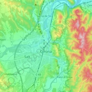
Name: Gerunda topographic map, elevation, terrain.
Location: Gerunda, Gironès, Gerunda, Catalunha, Espanha (41.93924 2.78310 42.02973 2.89824)
Average elevation: 135 m
Minimum elevation: 40 m
Maximum elevation: 370 m
Other topographic maps
Click on a map to view its topography, its elevation and its terrain.