
IJzendijke topographic map
Interactive map
Click on the map to display elevation.
About this map
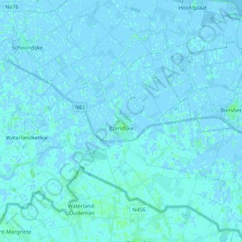
Name: IJzendijke topographic map, elevation, terrain.
Location: IJzendijke, Sluis, Seeland, Niederlande (51.27604 3.55849 51.37215 3.70142)
Average elevation: 0 m
Minimum elevation: -4 m
Maximum elevation: 4 m
Other topographic maps
Click on a map to view its topography, its elevation and its terrain.
Renesse
Niederlande > Seeland > Renesse
Renesse, Schouwen-Duiveland, Seeland, Niederlande
Average elevation: 1 m