
Thank you for supporting this site ❤️
Make a donation
Make a donation
Lac-Simon topographic map
Click on the map to display elevation.
Thank you for supporting this site ❤️
Make a donation
Make a donation
About this map
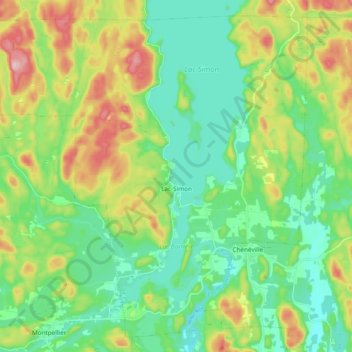
Name: Lac-Simon topographic map, elevation, terrain.
Location: Lac-Simon, Papineau, Outaouais, Quebec, Canada (45.85386 -75.21416 45.97441 -75.02441)
Average elevation: 249 m
Minimum elevation: 176 m
Maximum elevation: 405 m
Thank you for supporting this site ❤️
Make a donation
Make a donation
Other topographic maps
Click on a map to view its topography, its elevation and its terrain.
Thank you for supporting this site ❤️
Make a donation
Make a donation
Réserve écologique de la Forêt-la-Blanche
Canada > Quebec > Papineau > Mulgrave-et-Derry
Average elevation: 243 m