
Hamura topographic map
Interactive map
Click on the map to display elevation.
About this map
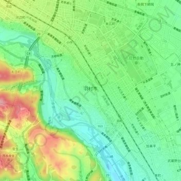
Name: Hamura topographic map, elevation, terrain.
Location: Hamura, Tokyo, Kanto, Japan (35.74712 139.29213 35.78136 139.34308)
Average elevation: 161 m
Minimum elevation: 108 m
Maximum elevation: 250 m
Other topographic maps
Click on a map to view its topography, its elevation and its terrain.