
安泽县 topographic map
Interactive map
Click on the map to display elevation.
About this map
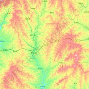
Name: 安泽县 topographic map, elevation, terrain.
Location: 安泽县, 临汾市, 山西省, 中国 (35.89052 112.00514 36.50529 112.56781)
Average elevation: 1,119 m
Minimum elevation: 746 m
Maximum elevation: 1,691 m
Other topographic maps
Click on a map to view its topography, its elevation and its terrain.