
僧楼镇 topographic map
Interactive map
Click on the map to display elevation.
About this map
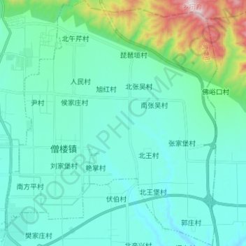
Name: 僧楼镇 topographic map, elevation, terrain.
Location: 僧楼镇, 河津市, 运城市, 山西省, 中国 (35.63067 110.71574 35.73086 110.82212)
Average elevation: 560 m
Minimum elevation: 408 m
Maximum elevation: 1,342 m
Other topographic maps
Click on a map to view its topography, its elevation and its terrain.