Geolocate

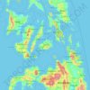
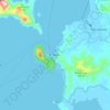
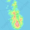
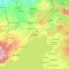
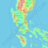
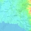
Samar topographic map

Click on the map to display elevation.

About this map

Name: Samar topographic map, elevation, terrain.

Location: Samar, Eastern Visayas, Philippines (10.95070 124.06727 12.33939 125.31719)

Average elevation: 94 m

Minimum elevation: -2 m

Maximum elevation: 1,291 m

Other topographic maps

Click on a map to view its topography, its elevation and its terrain.
Baguio

Philippines

In 1903, Filipinos, Japanese and Chinese workers were hired to build Kennon Road, the first road directly connecting Baguio with the lowlands of La Union and Pangasinan. Before this, the only road to Benguet was Naguilian Road, and it was largely a horse trail at higher elevations. Camp John Hay was…

Average elevation: 881 m
Quezon City

Philippines

Founded as a pueblo by Saint Pedro Bautista in 1590, San Francisco del Monte may be considered Quezon City's oldest district. The original land area of the old town of San Francisco del Monte was approximately2.5 square kilometres (1.0 sq mi) and covered parts of what is currently known as Project 7 and 8 and…

Average elevation: 57 m
Upper Agno River Basin

Philippines > Benguet

Average elevation: 1,289 m

Bohol

Philippines

Average elevation: 116 m

Meycauayan

Philippines > Bulacan

Average elevation: 27 m
Tayabas

Philippines > Quezon

Average elevation: 246 m

Parañaque

Philippines

Average elevation: 14 m

Lingayen

Philippines > Pangasinan

Average elevation: 4 m

Bacoor

Philippines > Cavite

Average elevation: 18 m

Santa Rosa

Philippines > Laguna > Santa Rosa

Average elevation: 65 m

Balingasag

Philippines > Misamis Oriental

Average elevation: 30 m

Echague

Philippines > Isabela

Average elevation: 71 m

El Nido

Philippines > Palawan

Average elevation: 33 m

Davao Gulf

Philippines

Average elevation: 0 m

Alabel

Philippines > Sarangani

Average elevation: 63 m

Camiguin Island

Philippines > Camiguin

Average elevation: 51 m

Bambang

Philippines > Nueva Vizcaya

Average elevation: 376 m

Botolan

Philippines > Zambales

Average elevation: 22 m

Jose Panganiban

Philippines > Camarines Norte

Average elevation: 41 m

Kabayan

Philippines > Benguet

Average elevation: 1,578 m

Nueva Ecija

Philippines

Average elevation: 112 m

Albay

Philippines

Average elevation: 48 m

Guiguinto

Philippines > Bulacan

Average elevation: 5 m

Panglao Island

Philippines > Bohol

Average elevation: 47 m

San Ildefonso

Philippines > Bulacan

Average elevation: 17 m

Pili

Philippines > Camarines Sur

Average elevation: 31 m

Ramon

Philippines > Isabela

Average elevation: 100 m

Initao

Philippines > Misamis Oriental

Average elevation: 42 m

Camalig

Philippines > Albay

Average elevation: 191 m

Dagupan

Philippines > Pangasinan

Average elevation: 12 m

Cebu City

Philippines > Cebu > Cebu City

Average elevation: 140 m

San Fernando

Philippines > Pampanga

Average elevation: 24 m

Tucdao

Philippines > Biliran

Average elevation: 55 m

Aurora Hill North Central

Philippines

Average elevation: 1,479 m

Santa Cruz

Philippines > Tarlac > Tarlac City

Average elevation: 37 m

Samar

Philippines

Average elevation: 38 m

Bulacan

Philippines

Average elevation: 105 m

Iligan

Philippines

Average elevation: 229 m

Nabua

Philippines > Camarines Sur > Nabua

Nabua has about 8,803.0600 hectares or 99.42% very low elevation or less than 100 meters elevation and remaining 51.3593 hectares or 0.58% of low elevation or between 100 and 300 meters elevation. Its slope covers about 7,927.3616 hectares or 89.53% which are level to nearly level (0-3%) while the remaining…

Average elevation: 14 m

Olongapo

Philippines > Zambales > Olongapo

Average elevation: 194 m

Tarlac City

Philippines > Tarlac

Average elevation: 56 m

Sorsogon City

Philippines > Sorsogon

Sorsogon City covers a land area of 31,292 hectares (120.82 sq mi). It is at the southernmost tip of the Bicol Peninsula and of Luzon Island. The city is bounded by Castilla in the west, Manito in the northwest, Albay Gulf in the north, Prieto Diaz in the east, Gubat in the southeast, Casiguran in the…

Average elevation: 90 m
Mandaluyong

Philippines

Another claims that the Spaniards named the place based on the report of a navigator named Acapulco, who saw the rolling hills frequently being lashed at by daluyong (“big waves from the sea”). This seems to confirm traditional pre-Hispanic stories that giant waves from the sea would meet the adjoining…

Average elevation: 33 m

Marikina

Philippines

Average elevation: 80 m

Cadlan

Philippines > Camarines Sur > Pili

Average elevation: 40 m

Tiwi

Philippines > Albay

Average elevation: 44 m

Dalig

Philippines > Rizal > Teresa

Average elevation: 73 m

Catmon

Philippines > Bulacan > Santa Maria

Average elevation: 31 m

Banjo Laurel

Philippines > Batangas > Tanauan

Average elevation: 167 m

Carmen

Philippines > Cagayan de Oro

Average elevation: 32 m

Lebak

Philippines > Sultan Kudarat

Average elevation: 19 m

Quirino

Philippines

Average elevation: 108 m

Tatala

Philippines > Rizal > Binangonan

Average elevation: 52 m

Pundaquit

Philippines > Zambales > San Antonio

Average elevation: 79 m

Romblon Island

Philippines > Romblon

Average elevation: 43 m

Cabatuan

Philippines > Iloilo

Average elevation: 74 m

Murcia

Philippines > Negros Occidental > Murcia

Average elevation: 126 m

Tanay

Philippines > Rizal

Average elevation: 32 m

Esperanza Ibaba

Philippines > Cavite > Alfonso

Average elevation: 459 m

Guimba

Philippines > Nueva Ecija

Average elevation: 35 m

Marawi

Philippines > Lanao del Sur

Marawi is located upon the shores of Lake Lanao.[6] It is primarily inhabited by the Maranao people. The city is also called the "summer capital of the south" due to its higher elevation and cooler climate,[7] a nickname it shares with Malaybalay.[8][better source needed]

Average elevation: 707 m

Kalanganan 1

Philippines > Cotabato City

Average elevation: 5 m

Culaba

Philippines > Biliran

Average elevation: 124 m

Bulan

Philippines > Sorsogon

Average elevation: 5 m

Duka

Philippines > Misamis Oriental

Average elevation: 51 m

Jiabong

Philippines > Samar

Average elevation: 48 m

Mondragon

Philippines > Northern Samar

Average elevation: 13 m

Tanawan

Philippines > Camarines Norte

Average elevation: 122 m

Surigao del Sur

Philippines

Average elevation: 274 m

Candaba

Philippines

Average elevation: 6 m

Culiat Creek

Philippines > Quezon City

Average elevation: 44 m

Catambungan

Philippines

Average elevation: 5 m

Buenavista

Philippines

Average elevation: 112 m

Tarlac

Philippines

Average elevation: 109 m

Nueva Vizcaya

Philippines

Average elevation: 107 m

Zone IV

Philippines

Average elevation: 4 m

Bontoc

Philippines > Southern Leyte

Average elevation: 37 m

Madridejos

Philippines > Cebu

Average elevation: 2 m

Magat River

Philippines

Average elevation: 46 m

Las Piñas

Philippines

Average elevation: 14 m

Rizal

Philippines

Average elevation: 95 m

Biñan

Philippines > Laguna > Biñan > Biñan

Average elevation: 101 m

Tabaco

Philippines > Albay

The City of Tabaco is located on the eastern coast of Albay province with an area of 117.14 km2 (45.23 sq mi). The terrain in the poblacion or town center of Tabaco is generally flat with the highest elevation at around 5 m (16 ft). The northwestern portion reaches 400 m (1,300 ft) above sea level. The city's…

Average elevation: 182 m

Naval

Philippines > Biliran

Average elevation: 31 m

Calauag

Philippines > Quezon

Average elevation: 28 m

Naawan

Philippines > Misamis Oriental

Average elevation: 26 m

Tagaytay

Philippines > Cavite

The southern and eastern portions of Tagaytay are covered by hills and mountains which is generally forests, pine trees and open grasslands. The city lies along Tagaytay Ridge, a ridge stretching about 32 kilometres (20 mi) from Mount Batulao in the west to Mount Sungay in the east with elevations averaging…

Average elevation: 229 m
Enrile

Philippines > Cagayan

Enrile is bounded by hills and mountains on both North and West. Area with low elevation is about 20 meters above sea level at the Eastern part which lies close to the river boundaries. The highest elevation is found Northwest which is approximately 800 meters above sea level.

Average elevation: 45 m
Daraga

Philippines > Albay

67.3% of the total municipal land area has a predominantly low elevation of up to 100 metres (330 ft). The surface terrain is generally characterized by combination of level to nearly level areas, gentle to undulating areas and undulating to rolling areas.

Average elevation: 76 m
Tagum

Philippines > Davao del Norte

One of the significant accomplishments of the officialdom of Tagum during the 1990s was its elevation from a second to the first-class municipality. This opened a gateway to increase its financial resources through the Internal Revenue Allocation (IRA) from the national government and local revenues. This was…

Average elevation: 103 m
Lapu-Lapu

Philippines

Average elevation: 93 m

San Juan

Philippines

"San Juan" is a contraction of the city's traditional name of "San Juan del Monte" (lit. 'Saint John of the Mountain'). As with numerous other places in the Philippines, the name combines a patron saint and a toponym; in this case Saint John the Baptist with the locale's hilly terrain and relatively higher…

Average elevation: 35 m
Pasay

Philippines

Average elevation: 14 m

Malolos

Philippines > Bulacan

Malolos is relatively flat of about 0.81% to a gently sloping of 2.17%. The slope of the land descends towards west, southwest to southern direction. The highest land elevation is at about 6.0 meters above sea level while the lowest is only half a meter below sea level. A network of natural waterways and…

Average elevation: 6 m

Malimatoc I

Philippines > Batangas > Mabini

Average elevation: 144 m

Patag Island

Philippines

Average elevation: 0 m

Kota Island

Philippines

Average elevation: 0 m