
Thank you for supporting this site ❤️
Make a donation
Make a donation
Injibara topographic map
Click on the map to display elevation.
Thank you for supporting this site ❤️
Make a donation
Make a donation
Injibara
Injibara (Amharic: እንጅባራ) is a town in Ethiopia. It is the administrative center of the Agew Awi Zone in the Amhara Region. Injibara is located at 10°57′N 36°56′E / 10.950°N 36.933°E / 10.950; 36.933, in Banja Shekudad woreda at an elevation of 2,560 meters (8,400 ft) above sea level.
Thank you for supporting this site ❤️
Make a donation
Make a donation
About this map
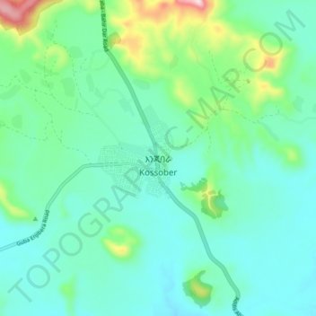
Name: Injibara topographic map, elevation, terrain.
Location: Injibara, Awi Agew, Amhara Region, Ethiopia (10.91855 36.89457 10.99855 36.97457)
Average elevation: 2,575 m
Minimum elevation: 2,485 m
Maximum elevation: 2,919 m
Thank you for supporting this site ❤️
Make a donation
Make a donation
Other topographic maps
Click on a map to view its topography, its elevation and its terrain.