
Thank you for supporting this site ❤️
Make a donation
Make a donation
Huancayo topographic map
Click on the map to display elevation.
Thank you for supporting this site ❤️
Make a donation
Make a donation
About this map
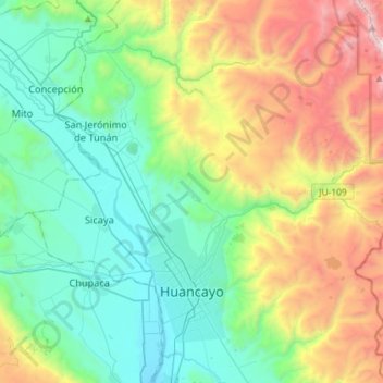
Name: Huancayo topographic map, elevation, terrain.
Location: Huancayo, Province of Huancayo, Junín, Peru (-12.08765 -75.23616 -11.90127 -74.94656)
Average elevation: 3,817 m
Minimum elevation: 3,161 m
Maximum elevation: 5,379 m
Thank you for supporting this site ❤️
Make a donation
Make a donation
Other topographic maps
Click on a map to view its topography, its elevation and its terrain.
Thank you for supporting this site ❤️
Make a donation
Make a donation
Thank you for supporting this site ❤️
Make a donation
Make a donation