Geolocate

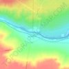
Valle Verde topographic map

Click on the map to display elevation.

About this map

Name: Valle Verde topographic map, elevation, terrain.

Location: Valle Verde, Departamento General Roca, Río Negro, Argentina (-37.61559 -68.03233 -37.61213 -68.02886)

Average elevation: 416 m

Minimum elevation: 409 m

Maximum elevation: 422 m

Other topographic maps

Click on a map to view its topography, its elevation and its terrain.
M639

Argentina > Río Negro > Cipolletti

Average elevation: 265 m

Pichi Mahuida

Argentina > Río Negro

Average elevation: 140 m

Punta Princesa

Argentina > Río Negro

Average elevation: 1,825 m

MT

Argentina > Río Negro > General Fernández Oro

Average elevation: 260 m