
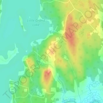
Horne Settlement topographic map
Interactive map
Click on the map to display elevation.
About this map
Name: Horne Settlement topographic map, elevation, terrain.
Average elevation: 25 m
Minimum elevation: 7 m
Maximum elevation: 51 m
Other topographic maps
Click on a map to view its topography, its elevation and its terrain.
Little Grand Lake
Canada > Nova Scotia > Enfield
Little Grand Lake, Sheridan Brook Road, Enfield, East Hants District Municipality, Hants County, Nova Scotia, B2T 1H9, Canada
Average elevation: 25 m