
Freihalden topographic map
Interactive map
Click on the map to display elevation.
About this map
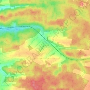
Name: Freihalden topographic map, elevation, terrain.
Average elevation: 518 m
Minimum elevation: 469 m
Maximum elevation: 550 m
Other topographic maps
Click on a map to view its topography, its elevation and its terrain.
Günzburg
Deutschland > Bayern > Landkreis Günzburg
Günzburg, Landkreis Günzburg, Bayern, 89312, Deutschland
Average elevation: 461 m