
平安区 / Ping'an topographic map
Interactive map
Click on the map to display elevation.
About this map
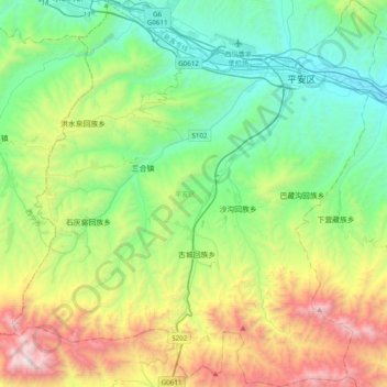
Name: 平安区 / Ping'an topographic map, elevation, terrain.
Location: 平安区 / Ping'an, ཙོང་ཁ་མཁར་ 海东市, Qinghai, RPC (36.25078 101.81017 36.56305 102.18643)
Average elevation: 2,750 m
Minimum elevation: 2,062 m
Maximum elevation: 4,377 m
Other topographic maps
Click on a map to view its topography, its elevation and its terrain.