
Wynyard topographic map
Click on the map to display elevation.
About this map
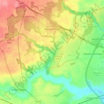
Name: Wynyard topographic map, elevation, terrain.
Average elevation: 49 m
Minimum elevation: 4 m
Maximum elevation: 96 m
Other topographic maps
Click on a map to view its topography, its elevation and its terrain.
Stockton-on-Tees
United Kingdom > England > Stockton-on-Tees > Stockton-on-Tees
Average elevation: 17 m
Stockton-on-Tees
United Kingdom > England > Stockton-on-Tees > Stockton-on-Tees
Average elevation: 20 m
Six Fields Nature Reserve
United Kingdom > England > Stockton-on-Tees > Stockton-on-Tees
Average elevation: 18 m