
Province of Lampa topographic map
Interactive map
Click on the map to display elevation.
About this map
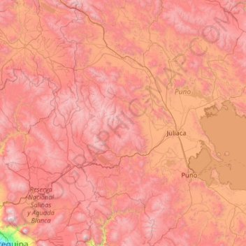
Name: Province of Lampa topographic map, elevation, terrain.
Location: Province of Lampa, Paratia, Lampa, Puno, Peru (-15.43667 -70.60333 -15.39667 -70.56333)
Average elevation: 4,719 m
Minimum elevation: 4,428 m
Maximum elevation: 5,075 m