
Thank you for supporting this site ❤️
Make a donation
Make a donation
Passewaaij topographic map
Click on the map to display elevation.
Thank you for supporting this site ❤️
Make a donation
Make a donation
About this map
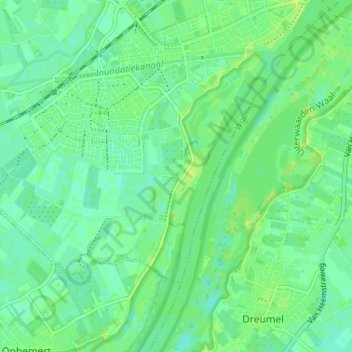
Name: Passewaaij topographic map, elevation, terrain.
Average elevation: 6 m
Minimum elevation: -1 m
Maximum elevation: 12 m
Thank you for supporting this site ❤️
Make a donation
Make a donation
Other topographic maps
Click on a map to view its topography, its elevation and its terrain.
Tiel
Nederland > Gelderland > Tiel
In 2011 werd ter hoogte van bedrijvenpark Kellen langs de Linge een vindplaats uit de nieuwe steentijd blootgelegd. De archeologen troffen bewoningssporen aan, aardewerk, vuursteen en dierlijk bot.
Average elevation: 6 m
Thank you for supporting this site ❤️
Make a donation
Make a donation