
Muxía topographic map
Interactive map
Click on the map to display elevation.
About this map
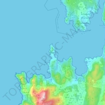
Name: Muxía topographic map, elevation, terrain.
Location: Muxía, Fisterra, A Corogne, Galice, 15215, Espagne (43.06712 -9.25819 43.14712 -9.17819)
Average elevation: 29 m
Minimum elevation: 0 m
Maximum elevation: 300 m
Other topographic maps
Click on a map to view its topography, its elevation and its terrain.