
La Warche topographic map
Interactive map
Click on the map to display elevation.
About this map
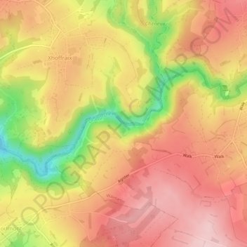
Name: La Warche topographic map, elevation, terrain.
Location: La Warche, Malmedy, Verviers, Liège, Wallonie, 4960, Belgique (50.44200 6.05854 50.45513 6.10632)
Average elevation: 510 m
Minimum elevation: 367 m
Maximum elevation: 595 m
Other topographic maps
Click on a map to view its topography, its elevation and its terrain.