
Thank you for supporting this site ❤️
Make a donation
Make a donation
Hannagan Meadow topographic map
Click on the map to display elevation.
Thank you for supporting this site ❤️
Make a donation
Make a donation
About this map
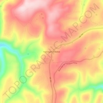
Name: Hannagan Meadow topographic map, elevation, terrain.
Location: Hannagan Meadow, Greenlee County, Arizona, United States (33.61964 -109.34724 33.65964 -109.30724)
Average elevation: 2,749 m
Minimum elevation: 2,555 m
Maximum elevation: 2,859 m
Thank you for supporting this site ❤️
Make a donation
Make a donation
Other topographic maps
Click on a map to view its topography, its elevation and its terrain.