
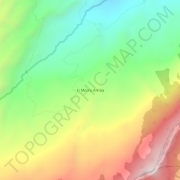
El Morro Arriba topographic map
Interactive map
Click on the map to display elevation.
About this map
Name: El Morro Arriba topographic map, elevation, terrain.
Average elevation: 1,877 m
Minimum elevation: 1,394 m
Maximum elevation: 2,536 m
Other topographic maps
Click on a map to view its topography, its elevation and its terrain.
Cuatro Esquinas
Colombia > Boyacá > Miraflores
Cuatro Esquinas, Miraflores, Lengupá, Boyacá, Colombia
Average elevation: 1,190 m
Vereda Arrayán
Colombia > Boyacá > Miraflores > Miraflores
Vereda Arrayán, Miraflores, Lengupá, Boyacá, RAP (Especial) Central, Colombia
Average elevation: 1,518 m