
Marshall State Fish and Wildlife Area topographic map
Interactive map
Click on the map to display elevation.
About this map
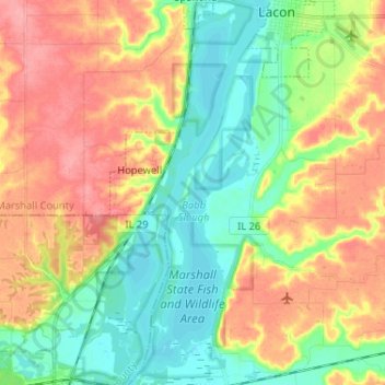
Name: Marshall State Fish and Wildlife Area topographic map, elevation, terrain.
Average elevation: 170 m
Minimum elevation: 133 m
Maximum elevation: 217 m
Other topographic maps
Click on a map to view its topography, its elevation and its terrain.
Wenona
United States > Illinois > Marshall County
Wenona, Marshall County, Illinois, 61377, United States
Average elevation: 214 m
Varna
United States > Illinois > Marshall County
Varna, Marshall County, Illinois, United States
Average elevation: 220 m
Hopewell
United States > Illinois > Marshall County
Hopewell, Marshall County, Illinois, United States
Average elevation: 177 m
Lacon
United States > Illinois > Marshall County
Lacon, Marshall County, Illinois, United States
Average elevation: 148 m