
Thank you for supporting this site ❤️
Make a donation
Make a donation
Ambhoda Kadam topographic map
Click on the map to display elevation.
Thank you for supporting this site ❤️
Make a donation
Make a donation
About this map
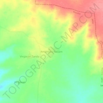
Name: Ambhoda Kadam topographic map, elevation, terrain.
Location: Ambhoda Kadam, Mantha, Jalna, Maharashtra, 431504, India (19.68665 76.44601 19.72665 76.48601)
Average elevation: 504 m
Minimum elevation: 465 m
Maximum elevation: 545 m
Thank you for supporting this site ❤️
Make a donation
Make a donation
Other topographic maps
Click on a map to view its topography, its elevation and its terrain.