
Thank you for supporting this site ❤️
Make a donation
Make a donation
Sonitpur topographic map
Click on the map to display elevation.
Thank you for supporting this site ❤️
Make a donation
Make a donation
About this map
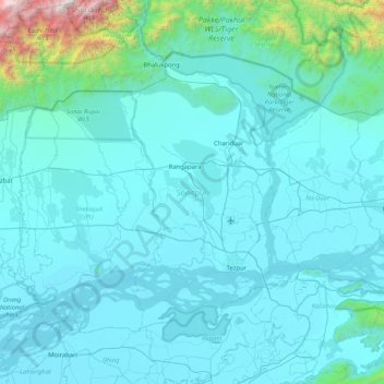
Name: Sonitpur topographic map, elevation, terrain.
Location: Sonitpur, Assam, India (26.49733 92.32289 27.03834 93.14640)
Average elevation: 260 m
Minimum elevation: 51 m
Maximum elevation: 3,226 m
Thank you for supporting this site ❤️
Make a donation
Make a donation
Other topographic maps
Click on a map to view its topography, its elevation and its terrain.