
Thank you for supporting this site ❤️
Make a donation
Make a donation
Wardville topographic map
Click on the map to display elevation.
Thank you for supporting this site ❤️
Make a donation
Make a donation
About this map
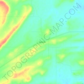
Name: Wardville topographic map, elevation, terrain.
Location: Wardville, Atoka County, Oklahoma, 74576, United States (34.63371 -96.05027 34.67371 -96.01027)
Average elevation: 210 m
Minimum elevation: 191 m
Maximum elevation: 244 m
Thank you for supporting this site ❤️
Make a donation
Make a donation
Other topographic maps
Click on a map to view its topography, its elevation and its terrain.