
Thank you for supporting this site ❤️
Make a donation
Make a donation
Stringtown topographic map
Click on the map to display elevation.
Thank you for supporting this site ❤️
Make a donation
Make a donation
About this map
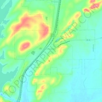
Name: Stringtown topographic map, elevation, terrain.
Location: Stringtown, Atoka County, Oklahoma, United States (34.44076 -96.07739 34.49051 -96.02731)
Average elevation: 197 m
Minimum elevation: 162 m
Maximum elevation: 275 m
Thank you for supporting this site ❤️
Make a donation
Make a donation
Other topographic maps
Click on a map to view its topography, its elevation and its terrain.
Thank you for supporting this site ❤️
Make a donation
Make a donation
Thank you for supporting this site ❤️
Make a donation
Make a donation