
Besinne topographic map
Interactive map
Click on the map to display elevation.
About this map
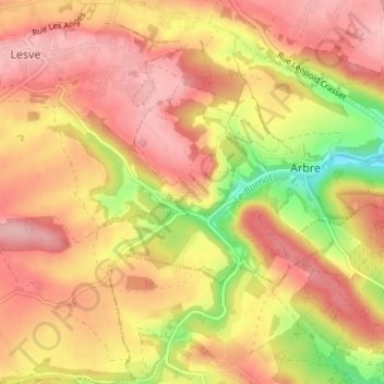
Name: Besinne topographic map, elevation, terrain.
Average elevation: 216 m
Minimum elevation: 128 m
Maximum elevation: 267 m
Other topographic maps
Click on a map to view its topography, its elevation and its terrain.
Bois-de-Villers
Belgique > Province de Namur > Namur > Profondeville
Bois-de-Villers, Profondeville, Namur, Province de Namur, Wallonie, 5170, Belgique
Average elevation: 223 m
Lesve
Belgique > Province de Namur > Namur > Profondeville
Lesve, Profondeville, Namur, Province de Namur, Wallonie, Belgique
Average elevation: 239 m
Lustin
Belgique > Province de Namur > Namur > Profondeville
Lustin, Profondeville, Namur, Province de Namur, Wallonie, Belgique
Average elevation: 199 m