
邕宁区 topographic map
Interactive map
Click on the map to display elevation.
About this map
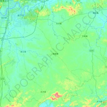
Name: 邕宁区 topographic map, elevation, terrain.
Location: 邕宁区, 南宁市, 广西壮族自治区, 中国 (22.41477 108.41384 22.81357 108.85695)
Average elevation: 118 m
Minimum elevation: 58 m
Maximum elevation: 422 m
Other topographic maps
Click on a map to view its topography, its elevation and its terrain.