
Triệu Sơn District topographic map
Interactive map
Click on the map to display elevation.
About this map
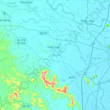
Name: Triệu Sơn District topographic map, elevation, terrain.
Location: Triệu Sơn District, Thanh Hoá Province, Vietnam (19.71217 105.42535 19.89212 105.71244)
Average elevation: 35 m
Minimum elevation: -1 m
Maximum elevation: 510 m
Other topographic maps
Click on a map to view its topography, its elevation and its terrain.
Ngọc Lặc District
Ngọc Lặc District, Thanh Hoá Province, Vietnam
Average elevation: 104 m