
Formerum topographic map
Interactive map
Click on the map to display elevation.
About this map
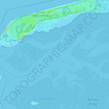
Name: Formerum topographic map, elevation, terrain.
Location: Formerum, Terschelling, Friesland, Niederlande (53.24254 5.25200 53.42534 5.53709)
Average elevation: 0 m
Minimum elevation: -21 m
Maximum elevation: 27 m
Other topographic maps
Click on a map to view its topography, its elevation and its terrain.
Terschelling
Niederlande > Friesland > Terschelling
Terschelling, Friesland, Niederlande
Average elevation: 0 m
Baaiduinen
Niederlande > Friesland > Terschelling
Baaiduinen, Terschelling, Friesland, Niederlande
Average elevation: 2 m
Hoorn
Niederlande > Friesland > Terschelling
Hoorn, Terschelling, Friesland, Niederlande
Average elevation: 2 m