
Thank you for supporting this site ❤️
Make a donation
Make a donation
Rochor River topographic map
Click on the map to display elevation.
Thank you for supporting this site ❤️
Make a donation
Make a donation
About this map
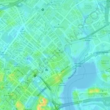
Name: Rochor River topographic map, elevation, terrain.
Location: Rochor River, Kallang, Singapore, Central, 200815, Singapore (1.30602 103.86170 1.30637 103.86250)
Average elevation: 10 m
Minimum elevation: -9 m
Maximum elevation: 42 m
Thank you for supporting this site ❤️
Make a donation
Make a donation
Other topographic maps
Click on a map to view its topography, its elevation and its terrain.