
Thank you for supporting this site ❤️
Make a donation
Make a donation
Altbüron topographic map
Click on the map to display elevation.
Thank you for supporting this site ❤️
Make a donation
Make a donation
About this map
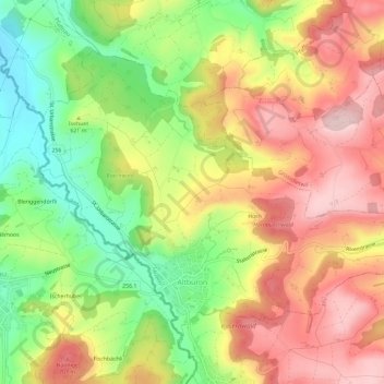
Name: Altbüron topographic map, elevation, terrain.
Location: Altbüron, Lucerne, 6147, Suisse (47.17616 7.85939 47.20558 7.91775)
Average elevation: 617 m
Minimum elevation: 484 m
Maximum elevation: 739 m
Thank you for supporting this site ❤️
Make a donation
Make a donation
Other topographic maps
Click on a map to view its topography, its elevation and its terrain.
Thank you for supporting this site ❤️
Make a donation
Make a donation