
Kamikawa District topographic map
Interactive map
Click on the map to display elevation.
About this map
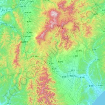
Name: Kamikawa District topographic map, elevation, terrain.
Average elevation: 481 m
Minimum elevation: 0 m
Maximum elevation: 2,217 m
Other topographic maps
Click on a map to view its topography, its elevation and its terrain.
Muroran
Muroran, Iburi Subprefecture, Hokkaidō Prefecture, Japan
Average elevation: 46 m