
Thank you for supporting this site ❤️
Make a donation
Make a donation
Brooklyn topographic map
Click on the map to display elevation.
Thank you for supporting this site ❤️
Make a donation
Make a donation
About this map
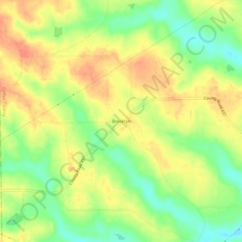
Name: Brooklyn topographic map, elevation, terrain.
Location: Brooklyn, Coffee County, Alabama, United States (31.29295 -86.19106 31.33295 -86.15106)
Average elevation: 87 m
Minimum elevation: 60 m
Maximum elevation: 109 m
Thank you for supporting this site ❤️
Make a donation
Make a donation
Other topographic maps
Click on a map to view its topography, its elevation and its terrain.