
Thank you for supporting this site ❤️
Make a donation
Make a donation
Munising topographic map
Click on the map to display elevation.
Thank you for supporting this site ❤️
Make a donation
Make a donation
About this map
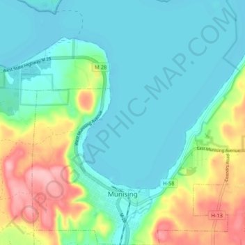
Name: Munising topographic map, elevation, terrain.
Location: Munising, Alger County, Michigan, 49862, United States (46.39838 -86.67921 46.45372 -86.60459)
Average elevation: 213 m
Minimum elevation: 176 m
Maximum elevation: 312 m
Thank you for supporting this site ❤️
Make a donation
Make a donation
Other topographic maps
Click on a map to view its topography, its elevation and its terrain.
Thank you for supporting this site ❤️
Make a donation
Make a donation
Christmas
United States > Michigan > Alger County > Au Train Township > Christmas
Average elevation: 203 m