
Thank you for supporting this site ❤️
Make a donation
Make a donation
Pichacani topographic map
Click on the map to display elevation.
Thank you for supporting this site ❤️
Make a donation
Make a donation
About this map
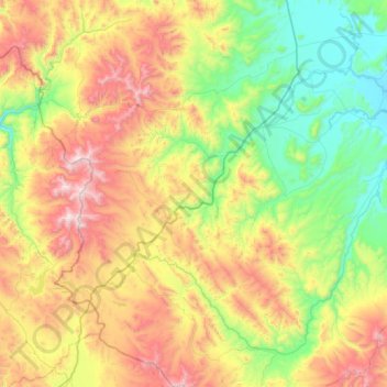
Name: Pichacani topographic map, elevation, terrain.
Location: Pichacani, Province of Puno, Puno, Peru (-16.53963 -70.38237 -15.96603 -69.93748)
Average elevation: 4,389 m
Minimum elevation: 3,870 m
Maximum elevation: 5,323 m
Thank you for supporting this site ❤️
Make a donation
Make a donation
Other topographic maps
Click on a map to view its topography, its elevation and its terrain.