
Thank you for supporting this site ❤️
Make a donation
Make a donation
Río Ranchería topographic map
Click on the map to display elevation.
Thank you for supporting this site ❤️
Make a donation
Make a donation
About this map
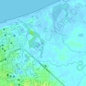
Name: Río Ranchería topographic map, elevation, terrain.
Location: Río Ranchería, Riohacha, La Guajira, 440007, Colombia (11.54031 -72.90469 11.55520 -72.88566)
Average elevation: 3 m
Minimum elevation: -2 m
Maximum elevation: 13 m
Thank you for supporting this site ❤️
Make a donation
Make a donation
Other topographic maps
Click on a map to view its topography, its elevation and its terrain.