
北佐久郡 topographic map
Interactive map
Click on the map to display elevation.
About this map
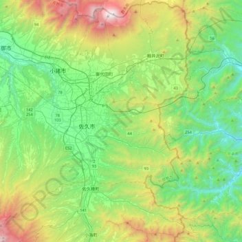
Name: 北佐久郡 topographic map, elevation, terrain.
Location: 北佐久郡, Prefectura de Nagano, 中部地方, Japón (36.08634 138.23387 36.42439 138.65716)
Average elevation: 974 m
Minimum elevation: 313 m
Maximum elevation: 2,560 m
Other topographic maps
Click on a map to view its topography, its elevation and its terrain.
Distrito de Sunto
Oyama, Distrito de Sunto, Prefectura de Shizuoka, 中部地方, 410-1431, Japón
Average elevation: 737 m