
Cumbal topographic map
Interactive map
Click on the map to display elevation.
About this map
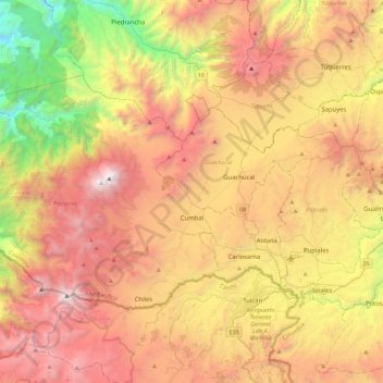
Name: Cumbal topographic map, elevation, terrain.
Location: Cumbal, Nariño, Kolumbien (0.80129 -78.20928 1.07796 -77.75610)
Average elevation: 2,557 m
Minimum elevation: 673 m
Maximum elevation: 4,734 m
Other topographic maps
Click on a map to view its topography, its elevation and its terrain.
Cerro Las Minas
Cerro Las Minas, Buesaco, Nariño, Kolumbien
Average elevation: 1,934 m