
Thank you for supporting this site ❤️
Make a donation
Make a donation
Alvor topographic map
Click on the map to display elevation.
Thank you for supporting this site ❤️
Make a donation
Make a donation
Alvor
The Prince Regent ordered, in the name of Manuel of Portugal, the elevation of Alvor to vila (town) on 28 February 1495, which was confirmed in a secondary diploma on 28 December 1498.
Thank you for supporting this site ❤️
Make a donation
Make a donation
About this map
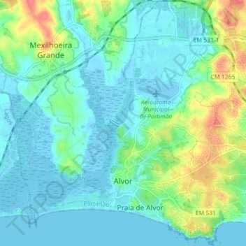
Name: Alvor topographic map, elevation, terrain.
Location: Alvor, Portimão, Faro, Portugal (37.11421 -8.62157 37.17064 -8.56067)
Average elevation: 15 m
Minimum elevation: -3 m
Maximum elevation: 62 m
Thank you for supporting this site ❤️
Make a donation
Make a donation
Other topographic maps
Click on a map to view its topography, its elevation and its terrain.