
Océan topographic map
Interactive map
Click on the map to display elevation.
About this map
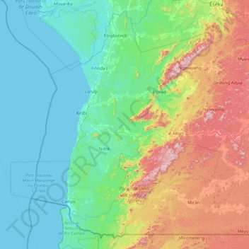
Name: Océan topographic map, elevation, terrain.
Location: Océan, Sud, Cameroun (2.14365 9.61763 3.59359 11.18000)
Average elevation: 229 m
Minimum elevation: 0 m
Maximum elevation: 1,051 m
Other topographic maps
Click on a map to view its topography, its elevation and its terrain.