
Thank you for supporting this site ❤️
Make a donation
Make a donation
Clugin topographic map
Click on the map to display elevation.
Thank you for supporting this site ❤️
Make a donation
Make a donation
About this map
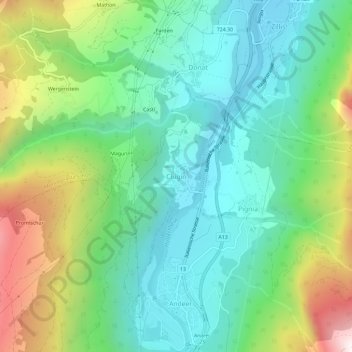
Name: Clugin topographic map, elevation, terrain.
Location: Clugin, Andeer, Viamala, Grisons, 7442, Suisse (46.59672 9.40626 46.63672 9.44626)
Average elevation: 1,307 m
Minimum elevation: 923 m
Maximum elevation: 2,174 m
Thank you for supporting this site ❤️
Make a donation
Make a donation
Other topographic maps
Click on a map to view its topography, its elevation and its terrain.
Thank you for supporting this site ❤️
Make a donation
Make a donation
Thank you for supporting this site ❤️
Make a donation
Make a donation